Summer heat arrives early
First 90-degree temps surge into Juniata Valley
LEWISTOWN — Summer is not on the calendar yet, but it will feel like it has moved in early this week. After a stretch of mild, breezy days and a pleasant weekend in the 70s and low 80s, the Juniata Valley is bracing for its first true burst of heat as temperatures soar into the 90s today and Tuesday.
The warmup has been building for days. After highs in the upper 60s Friday and near 70 Saturday, the region will climb into the mid-70s Sunday under a mix of clouds and sun. It is the kind of gentle, late-May warmth that usually signals the slow slide toward summer. This year, though, the slide turns into a jump.
“It seems to be the trend this spring and likely for summer,” explained David Martin, a meteorologist for the National Weather Service in State College. “It warms up early in the week then gets abnormally cold by the end of the week.”
A strong ridge of high pressure will settle over the Mid-Atlantic early this week, pulling hot southern air straight into Pennsylvania. By this afternoon, temperatures will surge to around 90 degrees, marking the first time this year the region has crossed that threshold. Tuesday will be even hotter, with highs near 92 and humidity creeping upward as dew points rise into the low 60s.
It will not be record-breaking heat, but it will be a noticeable shock after a spring that has been more cool than warm. The combination of heat and humidity will make it feel even hotter, especially during the peak afternoon hours. AccuWeather forecasts a UV index of 10 on both days, which means unprotected skin can burn in as little as 40 minutes.
A stray shower or thunderstorm could pop up late tonight, but most of the day will be sunny, hazy and hot. Tuesday brings another chance for a late-day shower, though most of the daylight hours will stay dry. Light to moderate breezes, generally 10 to 15 mph, will offer only limited relief.
The heat will not last long. A cold front will sweep through Wednesday afternoon and evening, bringing a higher chance of showers and a few thunderstorms. Temperatures will still reach the mid-80s before the front arrives, but once it passes, the pattern shifts sharply. Showers will taper early Thursday, and highs will fall back to the upper 60s and low 70s, much closer to seasonal averages.
By Friday and into the weekend, the Juniata Valley settles into a comfortable stretch of weather. Highs will hover near 70 Friday with only a slim chance of a passing shower. Saturday and Sunday look dry and pleasant, with highs in the mid-70s and partly cloudy skies. After the early-week heat, the cooler air will feel like a welcome reset.
“The jet stream pattern is very active, highly amplified,” Martin said of the jet stream, a narrow band of strong winds in the upper atmosphere that signicantly inlfluences weather patterns and climate across the globe. “It’s usually a trend for more weeks at a time.
“I think we’ll continue to see these radical swings,” Martin added. “We don’t normally see these this time of year. Usually when we see a big cool down, it stays cool for a while.”
Still, the brief blast of 90-degree heat is a reminder that summer is waiting in the wings. Early season heat waves are not unusual in Pennsylvania, but they can catch people off guard, especially when they arrive after a mild spring.
Forecasters recommend taking basic precautions: stay hydrated, limit strenuous outdoor activity during the hottest part of the day, use sunscreen and check on neighbors who may be sensitive to heat.
For now, the message is simple. Enjoy the warm weekend, brace for the heat today and Tuesday, and look forward to a cooler, calmer finish to the week. Summer may not be official yet, but it is about to make its presence known.
Local News
Calendar
Reserve Now: • Workplace seminar for local employers — 8:30 to 11:30 a.m., Tuesday, May 19, PA Careerlink ...

Outdoor author, content creator to host book signing in Lewistown
Authority, agencies make changes after accident at reservoir
MILROY — Craig Bubb has been working with the Mifflin County Municipal Authority for nearly 30 years, and nothing ...

Summer heat arrives early
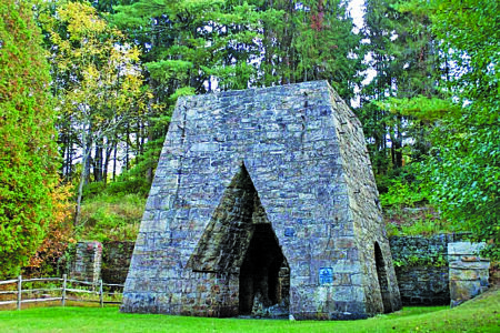
Honoring the past, celebrating the season: Memorial Day weekend at Greenwood Furnace
Skill games, sports betting interests are spending millions competing over 3 GOP state Senate primaries
by Stephen Caruso of Spotlight PA HARRISBURG — Gaming and gambling interests whose industries were eyed for ...